Related Articles


[ad_1]
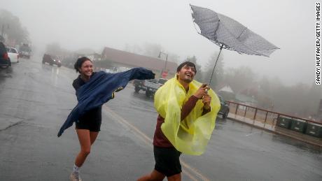
Kay has weakened from its earlier tropical storm strength when it struck the US, which had followed its landfall in Mexico as a Category 1 hurricane on Thursday. It will continue to weaken as it moves west off the northern Baja coast, roughly 120 miles southwest of San Diego, according to CNN meteorologist Derek Van Dam.
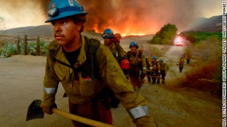
At 40% containment, the fire has killed two civilians and injured another, according to officials. The blaze has also destroyed 13 buildings, including homes, and damaged four others. It threatens an additional 10,000 structures.
But there is some relief in store, officials said, as rainfall moves through.
“The record heat that has plagued large portions of the West over the past week is coming to an end,” the weather service added. “Friday will likely be the last day of record heat through the interior Valleys of California with temperatures this weekend falling to levels closer to average.”
It has been so hot throughout the region that some effects of anticipated rainfall were lessened even further, officials said.
Fire weather prompts power outages
While some residents in the region will see a respite from the heat this weekend, others in the Pacific Northwest are forecast to experience an elevated risk for dangerous fire activity, the weather service warned.
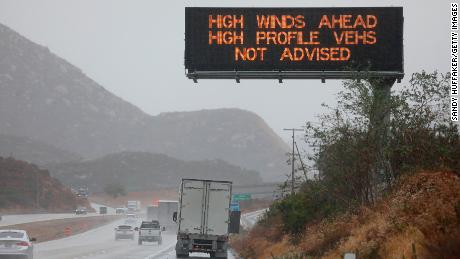
Farther north from the California coastline, this weekend’s warm temperatures paired with dry conditions may continue to threaten power outages in Oregon.
One power provider shut off electricity for 30,000 homes and businesses in Portland and Salem, Oregon, Friday to help reduce the risk of fire activity that could become dangerous.
The practice known as public safety shutoff is usually conducted in a limited area considered to be high risk of wildfire, Portland General Electric said. Other areas will also see outages due to “the imminent high winds, the extreme fire conditions currently found in Oregon,” the utility provider said.
Another 7,235 homes and businesses also experienced outages due to the hazardous fire weather conditions, according to provider Pacific Power.
“Over the course of the past two weeks, I’ve declared three fire conflagrations, as well as a statewide fire emergency to quickly marshal all available and necessary resources as wildfires arise,” Oregon Gov. Kate Brown said. “With seven active large fires in Oregon right now, more than 168,000 acres are burning across our state.”
Wind gusts in those areas may range from 25 to 50 mph, potentially aiding the rapid spread of fires
Meanwhile, many parts of California will not be affected by the rains of Kay and remain at higher risk for extreme conditions.
“The fire spread significantly overnight due to extreme fire behavior and heavy smoke limited visibility. The fire made uphill runs with short-range spotting. Weather will be minimal winds and 21% relative humidity,” Cal Fire officials said in an update.
CNN’s Paradise Afshar contributed to this report.
[ad_2]
Source link
